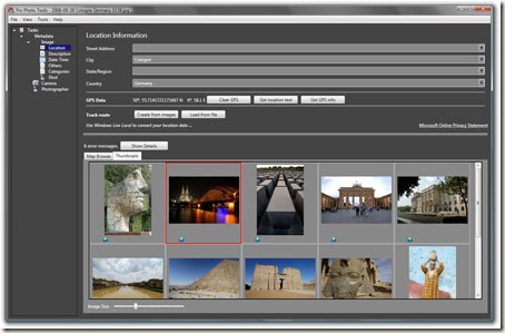
Edit a Photo’s Metadata with Microsoft Pro Photo Tools
Whenever you take a digital photograph, Metadata are automatically added to the digital photograph. Metadata can include information like the time when the photo was taken etc. Microsoft Pro Photo Tools is a free software which allows you to perform various tasks on your images like viewing/editing Metadata, RAW conversion, Geo tagging etc.
Most of the digital cameras that are available now support Geo Tagging. With this application, if your application contains GPS data, you can view the location in the built in earth viewer. You can also Geo Tag an image quickly by dragging it into any location in the map. You can add various data like street address, city, country and GPS coordinates will automatically be added. The information will be added to the metadata of images and you can also have real names instead of coordinates. Once an image has been Geo tagged, you can view it in Windows Live Map. It also supports RAW image formats which can also be converted to TIFF, JPEG and can also be resized. The Geo Tagging UI is very simple and easy to use.
Though it doesn’t provide many features, the Geo Tagging support is very useful. And more features is expected to be added on it soon. It works on Windows XP and Windows Vista having .Net Framework 3.


Surely a cool application! Thanks for a share. Link is not working though.